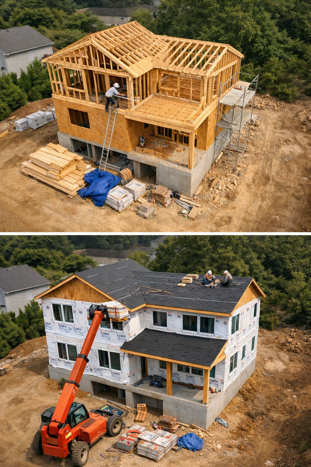
 Image 1 of 3
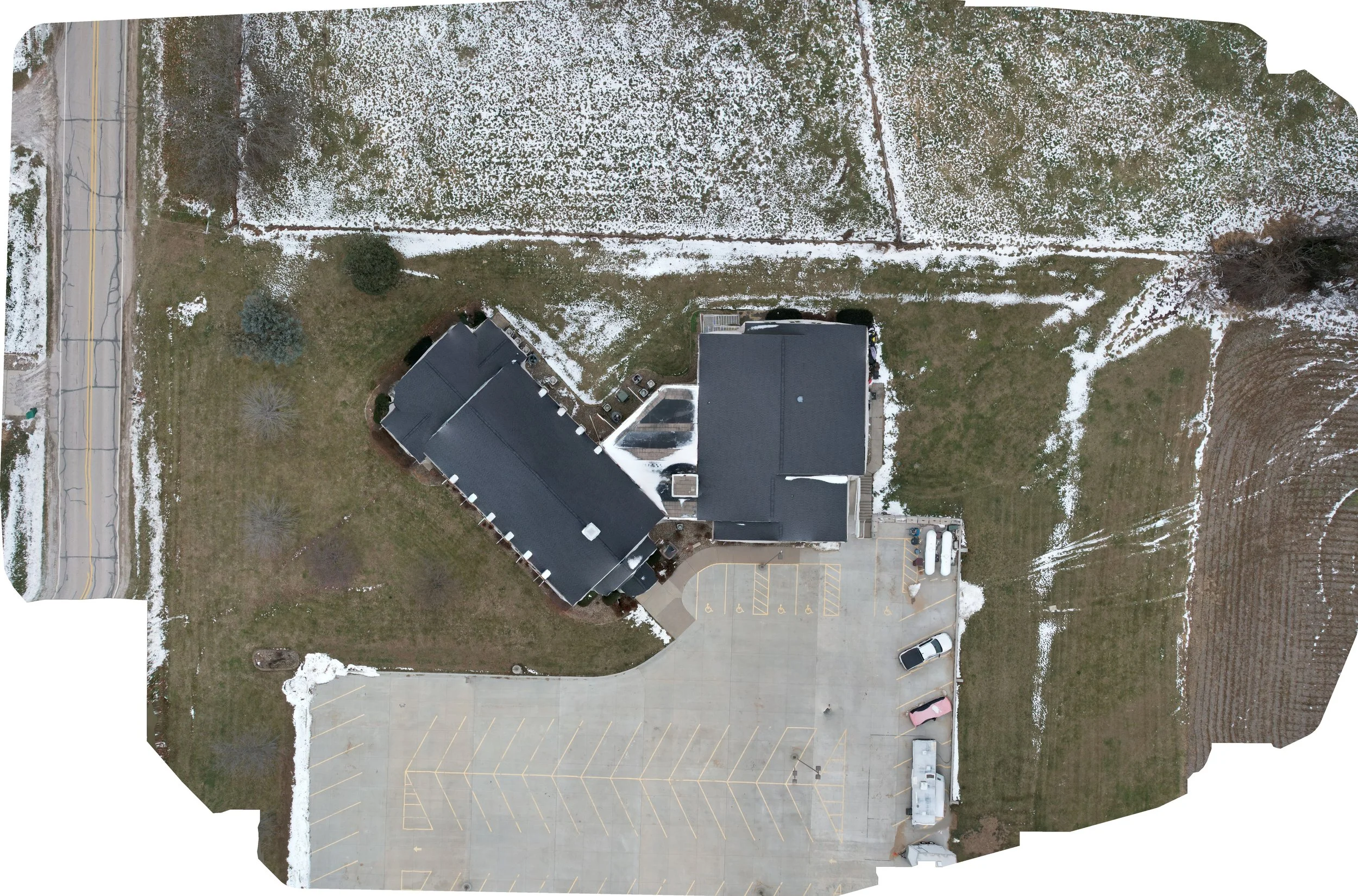 Image 2 of 3
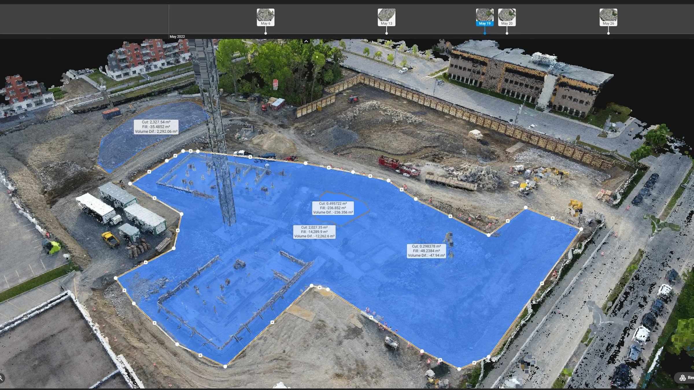 Image 3 of 3
Studio 5 Drone Productions provides professional construction progress tracking and aerial mapping services that give contractors, developers, engineers, and project managers a clear, up-to-date view of their job sites. Using FAA-certified drone operations, we capture consistent, high-resolution aerial data that helps teams document progress, verify work completed, and communicate accurately with stakeholders.
Our drone-based solutions reduce the need for frequent site visits, improve coordination between teams, and create a reliable visual record throughout the entire project lifecycle—from ground break to final completion.
✔ Consistent progress documentation for reporting and billing
✔ High-resolution aerial maps and site overviews
✔ Improved planning, communication, and accountability
✔ Fewer site disruptions and safer data collection
Built for Active Job Sites
We work seamlessly alongside construction operations, capturing aerial imagery and mapping data without interrupting crews or schedules. Whether you need weekly progress updates, milestone documentation, or detailed aerial maps for planning and verification, our services scale to match the size and complexity of your project.
Trusted, Professional, and Job-Site Ready
Studio 5 Drone Productions is Veteran-owned and operated, fully insured, and operated by FAA Part 107 certified pilots. We proudly serve construction projects across Iowa and Northern Missouri, delivering dependable aerial data that supports confident decision-making.
📍 Serving Iowa & Northern Missouri